Releases

Simulcast v7.0 Patch 1 Released - 5/22/2023
On behalf of the NASA Applied Sciences Disasters Program, we are pleased to announce the release of Simulcast v7.0 Patch 1. Patch 1 ensures that Simulcast will automatically retrieve ancillaries in light of updated security posture. Users of Simulcast are strongly encouraged to apply this patch to mitigate performance degradation.
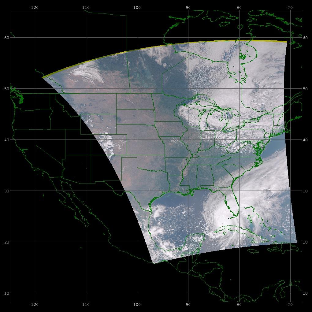
Simulcast is a multi-mission tool that enables a user to select and view quicklook instrument data (JPSS-2/JPSS-1/SNPP VIIRS as well as Aqua/Terra MODIS) in real time with a single Viewer. Simulcast processes and visualizes instrument data in real time, and accepts as input CCSDS packet streams (e.g., RT-STPS). Simulcast provides real-time pseudo-geolocation/calibration, and projects data on Mercator and Polar maps. Simulcast can replay recent satellite passes, export displayed images to JPEG format, and save replayed passes to AVI/Quicktime movies.
Simulcast features include:
- quicklook imagery that provides real-time downlink data quality assessment utility (e.g., Global Mission Operations, Regional Ground Station use);
- RGB for day and IR for night acquisition, as well as individual band analysis;
- downstream server configurations that enable open or secure collaboration by creating a user-defined local network of sites for real-time data sharing.
Access Simulcast v7.0. Patch 1, along with a README file containing installation instructions.

IPOPP v5.0 Released - 4/19/2023
On behalf of the NASA Applied Sciences Disasters Program, the DRL Team is pleased to announce the release of the International Planetary Observation Processing Package (IPOPP) Version 5.0. IPOPP v5.0 produces SNPP/NOAA-20/NOAA-21(engineering only) VIIRS and OMPS output, as well as Terra/Aqua MODIS output. This version continues migration of SNPP-era algorithms (eg. ROSES) into IPOPP with present and future NASA Science Investigator-led Processing Systems (SIPS) heritage while retaining compatibility with the SNPP-era NOAA data model (xDR formats).
Enhancements to IPOPP v5.0 include but not limited to:
-
Support for the NOAA-21 (JPSS-2) satellite as an engineering release:
- Ingester discovers and registers NOAA-21 data for higher level processing.
- Dashboard has new tabs for NOAA-21 processing configuration and monitoring.
- VIIRS SPAs (engineering releases) have been extended to process NOAA-21 data.
- OMPS SPA suite coming soon…
- Ingester discovers and registers MODIS and VIIRS L1 inputs from external sources (e.g., LSIPS, DAACs) for higher level processing.
- SNPP/NOAA-20/NOAA-21 refactor of SPA environments to include application-specific format converters yielding reduced complexity and enhanced efficiency.
- IPOPP v5.0 has been ported to run on Ubuntu 20. Ubuntu 20 has superseded CentOS 7 as the DRL’s officially supported operating system.
- Bundled custom Java Run-time Environment (JRE) for Linux (Oracle OpenJDK 11.0.1) now included within IPOPP. This architectural change intends to promote greater portability and reliability given the significant changes in support of NOAA-21.
This processing package contains both the data processing framework and select SPAs to form a generalized autonomous data processing basis (data model agnostic) that may be uniquely value-added by our commercial colleagues and power users. The generalized architecture has been demonstrated by users as a basis for algorithm evaluations for providing feedback to science teams; heterogeneous implementation where the core resource management is verbose and easily referenced yielding ambiguity mitigation when performing detailed inter-comparisons.
Special thanks to our ROSES collaborators (principally, Geographic Information Network of Alaska and Finnish Meteorological Institute) for their contributions on a prototype IPOPP v5.0 for ultra-low latency applications named IPOPP-Parallel. Based on assets at DRL, for example, an entire swath of SNPP/NOAA-20 (13min of downlink acquisition—longest swath) VIIRS thru L2 products was produced in 6min.
All SPA releases are first evaluated in the Global View Testbed prior to public release to our global users. In this environment, the system of systems produces global SNPP, NOAA-20 and NOAA-21 data products from the Stored Mission Data (SMD) downlink. This capability provides a quality monitoring tool for use by the Principal Investigators and the algorithm development teams. The utility of the global IPOPP processor technologies:
- enables application on a global scale;
- enhances algorithm development and implementation;
- enables scientific analysis in a Geographic Information System (GIS) environment; and
- contributes to capacity building while reinforcing NASA's commitment to the international disaster charter using real-time and near real-time assets.
Global imagery as indicator of work in process. 🙁
IPOPP v5.0 includes the following SNPP-era SPAs as an IPOPP plug-in (standalone mode no longer supported). Special thanks to the Land, Atmosphere, Ocean and Ozone Science Teams for their science-sanctioned contributions:
- VIIRS-L1, to produce VIIRS Level1A, 1B, Geolocation and Onboard Calibration;
- L1toSDR, format converter to produce VIIRS SDRs from VIIRS-L1 input where needed;
- ENCC, to produce ENCC DNB ENCC albedo and ENCC Day/Night imagery;
- VFIRE375 SPA, to produce a two-dimensional fire mask in HDF and a fire location text file;
- Cloud Mask, to produce the VIIRS Cloud Mask product;
- Aerosol, to produce the VIIRS Aerosol Optical Thickness (AOT), Aerosol, Suspended Matter, Aerosol Model Information, and the Aerosol Geolocation;
- Surface Reflectance (SurfReflect), to produce the VIIRS Surface Reflectance;
- Vegetation Index (VegIndex), to produce the VIIRS Vegetation Index;
- Cloud Optical Properties (COP), to produce the VIIRS Cloud Optical Properties and the VIIRS Ice & Night Water Cloud Top Temperature;
- Snow Cover (SnowCov), to produce the VIIRS Snow Cover Binary Map and VIIRS Snow Cover Fraction;
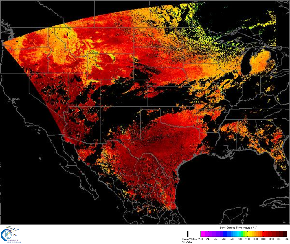
- Land Surface Temperature (LST), to produce the VIIRS Land Surface Temperature
- CVIIRS, to produce the VIIRS Corrected Reflectance;
- VIIRS-AF, to produce moderate resolution VIIRS Active Fires/Fire Mask;
- L2GEN, to produce the VIIRS Level 2 Ocean Color (including Chlor-a) and Sea Surface Temperature (SST)
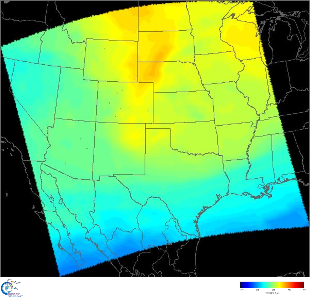
- OMPSnadir, to produce Total Column SO2, UV Aerosol Index, Total Column Ozone and Effective Surface Reflectivity;
- BlueMarble, to create MODIS sharpened True Color and Natural Color imagery; VIIRS sharpened True Color and Natural Color imagery; VIIRS Enhanced Near Constant Contrast (ENCC) day and night imagery; and overlays of OMPS SO2 and OMPS Ultraviolet Aerosol on True Color, Natural Color or ENCC geotiff imagery.
IPOPP v5.0 also includes these Terra/Aqua SPAs as an IPOPP plug-in. Special thanks to OBPG, CIMSS, and the MODIS Land Team for their science-sanctioned algorithm contributions:
- MODISL1DB, to produce the MODIS Geolocated/Calibrated product;
- CREFL, to produce the MODIS Corrected Reflectance;
- GBAD, to produce ephemeris and attitude files (input for Aqua L1);
- IMAPP, to produce the MODIS Level 2 Cloudmask, Cloudtop Properties, Cloud Phase, Atmospheric Profiles, and Aerosol;
- L2GEN, to produce the MODIS Level 2 Ocean Color (including Chlor-a) SST;
- MOD14, to produce the MODIS Level 2 Fire Mask;
- MODLST, to produce the MODIS Level 2 Land Surface Temperature (LST);
- NDVIEVI, to produce the MODIS Level 2 Normalized Difference Vegetation Index (NDVI) and Enhanced Vegetation Index (EVI).
Access IPOPP v5.0. Note: IPOPP users must update to version 5.0 NLT April 25, 2023 to ensure continuous acquisition of required ancillaries for product creation. Please be sure to update before this date. This is as a result of NASA security.

RT-STPS v7.0 Patch 1 Released - 11/23/2022
We are pleased to announce the release of RT-STPS v7.0 Patch 1. Patch 1 updates RT-STPS JPSS-2 configuration files to ensure RDR (NOAA Data Model) and PDS (NASA Data Model) output includes all necessary APIDs, providing a more seamless capability for higher-level processing.
Keep in mind that JPSS-2,3,4 is a new platform so there are many differences but the package(s) provided intend to make these significant differences transparent to the user as much as possible. We will make additional updates in the future as necessary.
The Real-time Software Telemetry Processing System (RT-STPS) is a Java real-time application that ingests telemetry data from a spacecraft transmission or from an equivalent demodulated file, performs multi-mission protocol processing including link-layer artifact corrections, provides data integrity statistics, and produces output to a file or TCP/IP socket.
RT-STPS is preconfigured to enable the Direct Readout Community to acquire transmissions from NOAA-21, NOAA-20, S-NPP, Terra, and Aqua, thereby producing output in numerous file formats. The preconfigured output formats are:
- Raw Data Records (RDR) for the NOAA-21, NOAA-20, and SNPP VIIRS, CrIS, ATMS, and OMPS instruments.
- Production Data Set (PDS) files for the NOAA-21, NOAA-20, and SNPP VIIRS, CrIS, ATMS, and OMPS instruments.
- PDS files for the Terra MODIS, Aqua MODIS, AIRS, AMSR, AMSU, and CERES instruments
Access RT-STPS v7.0 Patch 1, test data, and a README file containing installation instructions
